This week’s storm in the Adriatic has been a doozy – one of the most powerful in years. Calling it the storm of the century isn’t terribly helpful, as this is only 2019, but you’d have to go back to the 1960s to find something similar. The maximum wind gusts at Marijan in Split were recorded at 134 km/hr, which gives it 3rd place in the all-time storm records for Split. Storm surges were seen in Split and Zadar, while record waves of 10.87m were clocked near Dubrovnik.
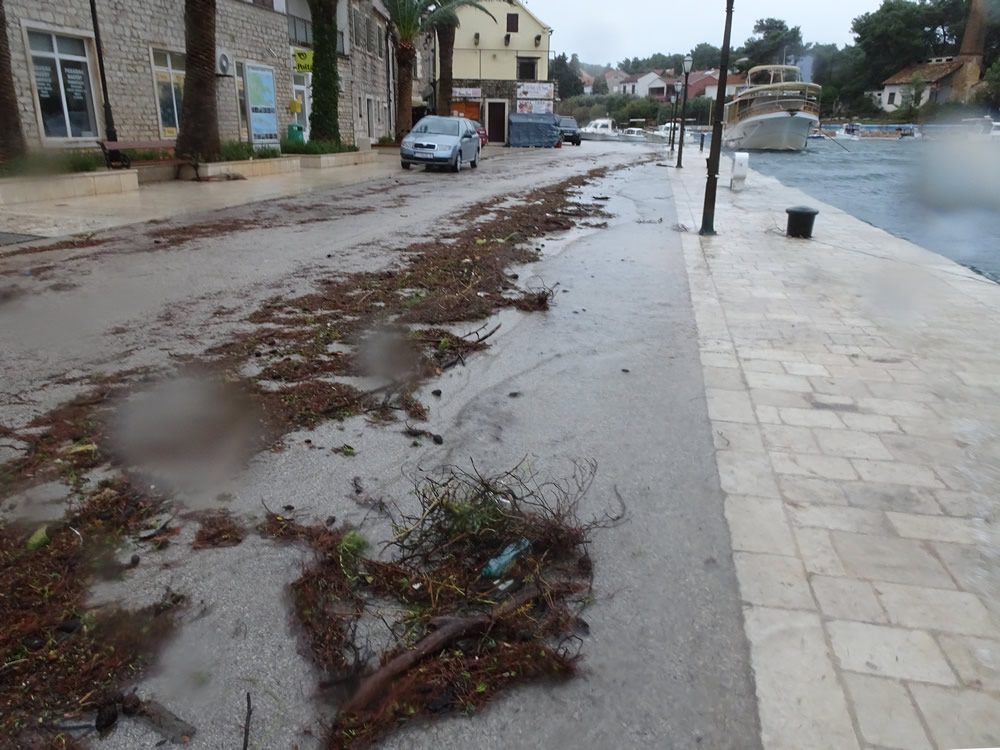
Debris marks high water
Here in Vrboska, the mountains protect us from the main force of the jugo, which blows directly from the south. By the time we receive it, the wind has curved around the terrain and arrives from the southeast, whipping up waves into the entrance of our long, narrow inlet. The wind may not be as powerful by that time, but if the timing of the gusts and the waves resonate, plus the air pressure is low and rapidly changing, it can set us up for an interesting effect in the harbour, known locally as šćiga.
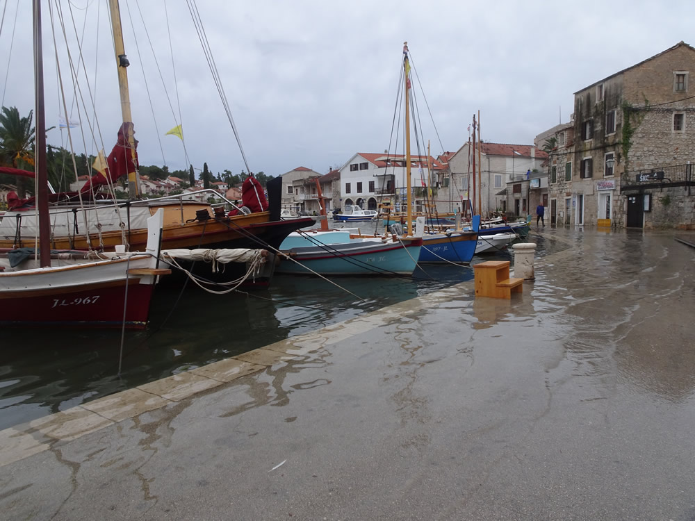
Floating high
Harbour resonance is like the slopping of a bathtub. It has a certain frequency based on the length of the inlet, the slope of the seafloor, etc, and if wind and waves also reinforce it at the right time, we get an effective tsunami, a rush of water back and forth. It can last anything from a few minutes to several hours, as it did last Tuesday.
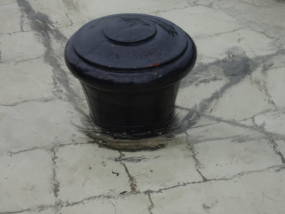
High water
The scientific term for a šćiga is meteotsunami – that is, a tsunami caused by weather and atmospheric conditions. It’s rarely as powerful as one caused by earthquakes or landslides, but it does bring a flood of extra water, which has to go somewhere as the inlet narrows. Vrboska, Stari Grad, and Vela Luka (on Korčula) all suffer from the same effect. In fact, the Great Flood of Vela Luka in 1978 is the strongest known meteotsunami, when tsunami-like waves with a height of 6m and period of around 20 minutes suddenly appeared, causing serious flooding and damage to property. Meteotsunamis are also known in Menorca, Malta, Sicily and Greece, as well as around the world in Japan, China, Australia, the Great Lakes, and the east coast of the U.S.
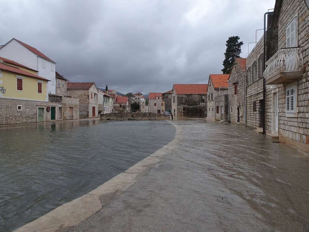
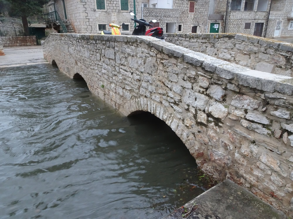
Water up to the arches
The Croatian catalogue of recent meteotsunami events in the Adriatic shows 27 separate reported events since 1931, some of which affected several harbours up and down the coast. Vrboska gets a mention in November 1951, May 2006, June 2014 and June/July 2017. To which we can now add November 2019. Stari Grad appears 8 times, while Vela Luka tops the chart at 14 events (half the total).
Water under the bridge
An earlier report of a šćiga in Vrboska dates to 11th April 1614, as background to the famous incident of the bleeding cross. Two factions of the village had been in dispute as to the separation of the Vrboska parish from the Vrbanj one. But a young girl, Katarina Ordinanović, saw tears of blood dripping from a crucifix in the family home. The shocked family called upon other villagers and the pastor to witness the miracle, and it was decided to take the cross to the St Mary fortress church. While the procession was taking place, a meteotsunami (šćiga) flooded the village and it was impossible to cross by the bridge, so they had to go all the way around, through the disputing communities of Podva and Pjaca. Christ’s tears and the šćiga were seen as a sign that the people of Vrboska should make peace.
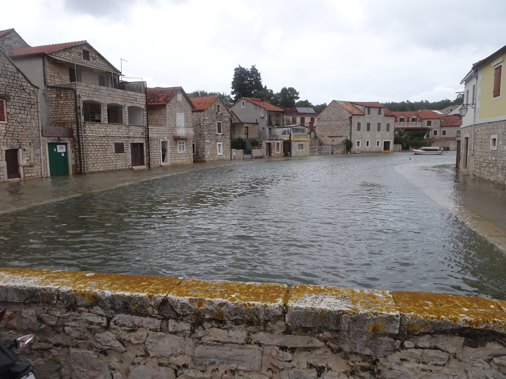
From the bridge
Two years ago, on 30th June 2017, Vrboska was hit by meteotsunami waves starting around 23:00, and lasting for much of the following day. This appears to have been an extreme šćiga, as videos show that at some point in time, part of the harbour was left without water, only to be flooded again a few minutes later as the water rushed back in, reaching over 20cm above the level of the dockside.
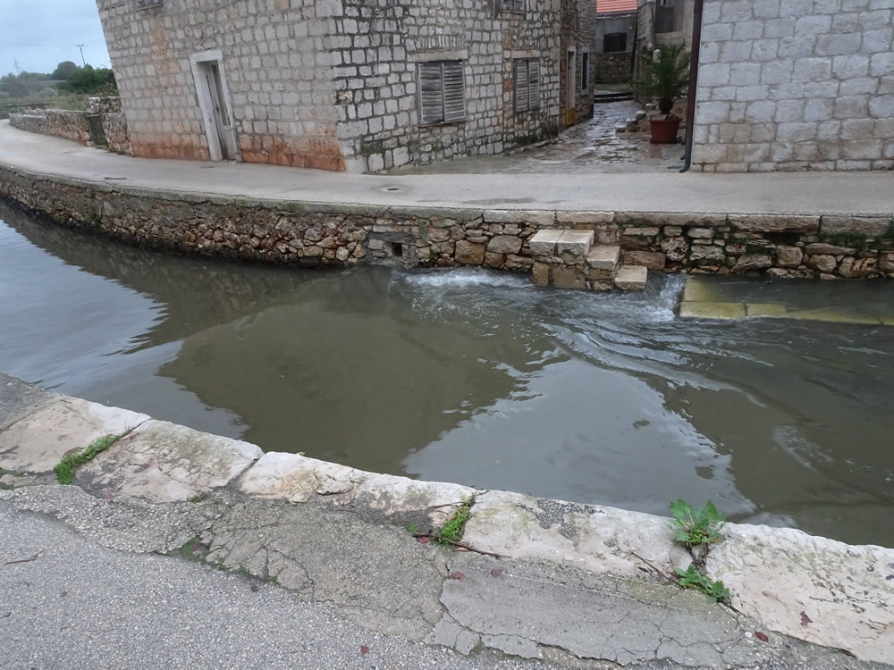
Wave coming in
We missed seeing the 2017 šćiga at its height (so to speak), but we did watch the water on Tuesday with some fascination. In the harbour itself, the boats had to be tied securely from the constant back and forth of the water. The sea was already above the usual high tide level because of the storm surge, yet it kept rising, washing over the dockside and leaving us standing in around 10cm of water. Just as well we thought to wear our wellies!


Up at the top end of the harbour, as it narrows right down and the walls are higher, we watched the waves breaking as they rolled in. Between one wave and the next was about 5-6 minutes, during which time the water was rising and falling over a metre. This in a harbour that usually sees tides of only ±20 cm!

")
")
")
")
")

And a video of the incoming wave…
Read more…
Meterological Tsunamis in the Adriatic Sea
Institute of Oceanography and Fisheries
Hrvatski Hidrografski Institut


Hvala na ovom opisu.
Very informative… I’m sharing this with a colleague urban planner who is interested in sea level rise.
I’m glad you found it interesting, and the references will provide more details of what’s going on. There’s been quite a lot of analysis on the 1978 Vela Luka flood particularly.
It is a shame that none of the government officials are learning lessons from history about this…
Well, I’m not sure about nothing being done. From what I read, there are monitoring stations around the Adriatic to give warnings of when meteotsunamis are likely. Also, there was considerable analysis done after the 1978 Vela Luka flood to understand, and hopefully prevent such massive damage again. On the subject of town planning, I’m afraid I don’t know.